This spring I returned to Rolwaling Valley for the first time since 2003. I had been working on a study-abroad program with the botany department at Tribhuwan University which would entail field work in Rolwaling as well as in the Khumbu and needed to update myself on the logistics. The notes below are excerpts from my trail log, written as an extended letter to my wife Empar. This part covers the trek from the district capital, Dolakha, up the Tamba Kosi to the junction with the Rolwaling River at Simigaon. Keep in mind that I am 60, haven't trekked for eight years, and, despite running a few half-marathons, am not in great shape. And carrying a 55-pound backpack... so there was quite a bit of soul-searching to expurgate. This isn't pretty. And it sure isn't inspiring.

April 28 [four days after landing in Kathmandu] Nadaha village.
Well, I screwed up big time... but lucked out equally big time.
I slept very little last night, despite the San Miguel and sleeping pill. Normally you have to buy bus tickets the day before the trip, but yesterday was a bandh [general strike] and the bus station was closed, so I was worried I might not be able to get a seat. Finally got up around 4 and reached the bus station about 5:15. I had no trouble getting two one-way tickets for two seats [265NR each, about US$3.75]; the second was for my bag -- I've heard stories of backpacks being plundered or even stolen from the roof-top. A lot of passengers ride up there, and it's not at all possible to monitor what is unloaded at the frequent stops. The downside is that the seats sell out quickly -- and then dozens more passengers jam into the aisles, all giving me the hairy eye because I've got my backpack on a seat instead of on the roof.

Pre-dawn at Kathmandu's "Old Bus Station"

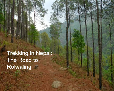
New path out of Dolakha
The bus left on time, at 5:45 am, and reached Dolakha at 12:45 pm instead of 11, which is probably a standard delay. The bus stopped for a lunch break at Muldi -- it just barreled through Lamosangu, where the bus used to stop for lunch. I didn't get out of the bus. I wasn't particularly hungry because I had eaten three of the four Mars bars I bought for the trail -- one late last night with the San Miguel, one at 4:10 as breakfast, and the other at 10:30 on the excuse that the remaining bars were melting. The fourth is sitting on a stool; maybe it will recover in the night.
As soon as I had unloaded at Dolakha, I struggled into my pack and headed out of town: there were too many spectators to start setting up my hydration pack. Despite the mid-day sun, I knew there were chances of a pre-monsoon afternoon shower, and I wanted to reach Singate, three or four hours away.

View below Dolakha

Abandoned hotel-restaurant
The path down through Dolakha to the Tamba River far below had changed. It no longer follows the crest of the ridge directly to the blue bridge. The broken mud-packed trail has been widened, and the upper kilometers have been paved with bone-jarring broken stones. And, as I gradually realized, the route is much much longer. Even with the switchbacks, it was steep enough to torture my toes -- I should have tested my new boots more seriously before committing. So, I went hobbling along with my lathi [walking stick], trying to soften the shock of each step. The sun was hot, even with my hat. I still didn't want to stop to adjust my Liquipak or get out my water bottle, as it thought it would be only an hour till I reached cold water (or Orange Fanta) at our usual pit stop by the blue bridge.

North of Ratomati
Finally, after 2+ hours, as I was skirting a village beyond which I was nearly sure the blue bridge would be visible, I absolutely had to stop for water. But then I pretty much collapsed. I was fighting to resist heat stroke. Lay down by a wall next to the path and tried to avoid passing out, but I many have done so anyway when I thought I was just napping. Some people came to check me out, ask where I was going. I had reluctantly decided to stay the night at the blue bridge, and go for Singate tomorrow. But this guy tells me there's no more hotel or restaurant at the bridge. I asked him if there was a place to stay here. In Nadaha. I never heard of it, either.
...and now I'm lying in a comfortable room, with an electric light bulb, stuffed after a delicious daal baht tarkari (lentil-rice-vegetable) -- one of the best we've ever had on trek. It started to rain soon after I got here. If I had tried to reach Singate, or even Piguti, I would have been screwed.
The only downside to this place is that the guy blabs a lot in Nepali. I keep telling him that I know only a little, but that just sets him off more enthusiastically. On the other hand, I've learned a few things. For starters, the bus, which I knew goes to Singate (and was in fact thinking of taking on the way back) apparently reaches Jagat. Also, the Chinese are heavily involved in road-building upstream, ostensibly to support the construction of the hydroelectric plant at Lamobagar, which was paid for in large part by the Norwegians.
It is POURING now. I'm going to have to try to avoid hiking in the afternoon, or I get soaked and lose days drying out. Don't even know if the mornings are safe.

April 29 4:40 pm Jagat. Lying in bed with my pants open, trying to dry out my diaper rash.
I've been worried that I couldn't handle the trek physically. I think that will dissipate. Yesterday I was near dead. Today I am tired, constipated, with diaper rash and achy toes, but I think I'll be able to pull myself together.
This morning I left Nadaha at 6:15, after a breakfast of black tea and crackers. That's all I've had today -- tea and a few crackers. I'm afraid to eat while I'm constipated. I took a couple more Dulcolax. Let's see what happens.
It was nice this morning -- a little cool and overcast. My toes were a bit better since I removed both the arch supports and also an insert I had transplanted from my old boots. I was worried my arches would collapse like that time in Australia, but so far so good.
The blue bridge was just a few minutes away from where I collapsed yesterday, but, as my host had told me, the hotel/restaurant was gone. Too bad. I wonder if it was pressure from the Maoists, or the diversion of traffic once the road from Dolakha to Singate was stabilized.

Approaching Piguti

Piguti (above and below)

I walked on through Ratomati to Piguti -- took a couple of hours or more. I was thinking I might stop for tea at our usual place, but that didn't seem operative. Instead I witnessed, or semi-witnessed, an appalling scene. A woman was holding a young child, maybe two years old, who was sort of half-wailing. A man with a serious face and set jaw was doing something with a blood-soaked bandage, sprinkling powder on a wound that I couldn't quite see, but looked like the kid's hand was completely mangled. I thought maybe I should stop and offer medicine, but they have a pharmacy, and the guy was acting like he knew what to do, so I just walked by. I'm sure that scene is going to be in my head forever.
I went on to Singate, fully expecting to stay there, either at Malla's old inn, or at the place owned by the son of my host last night. His name, by the way: Stalin Shrestha. I thought I had heard wrong; just now I looked in my notebook where he had written it down. Anyway, I didn't see anything that was clearly a hotel, which struck me as odd, since a couple of new places had popped up south of the Singate bridge last time we were here. So I decided to head to Surye Dhoban or Jagat. Turned out the new road had supplanted most of our former trail. Ugly, but convenient. I didn't even have to cross the river to Surye Dhoban -- just stayed on the west side of the river until about halfway to Jagat.

Landslide-cut path above Singate

New road along the Tamba (above, and several photos below)


I was having a black tea, about two hours out of Singate, when two guys showed up on a motorcycle. Seems I missed their checkpoint in Singate. I showed them my Trekkers' Information Management System card (green version "for individual trekkers" US$20, available at the Nepal Tourism Board office in Brikuti Mandap). However, they wanted an additional 2000 NR (about $30) for the new Rolwaling Protected Area. They actually wanted me to return to Singate with them because they hadn't brought the form I was supposed to fill out. I flatly refused to give up the hours of walking in the hot sun and go back. Instead, I got them to write a receipt in my notebook. Not that it will do any good -- that was the only checkpoint going up to Rolwaling.
The one lodge I saw in lower Jagat turned out to be the camp ground next to our old hotel. The Pitzer group [from Pitzer College in California] is here. I had a chat with Margaret Donahue. The students were bused direct to Singate and got here in one hour (!) with porters carrying everything. They're all happy and fresh, playing with the kids and hugging each other. And they are all fluent in Nepali after a two-month total immersion course in Kathmandu. So, whatever happens in Simigaon [where the group is based for the rest of the semester], they have already achieved something fantastic.
The point keeps coming up that I am traveling alone. Very dangerous. Margaret and the host's 16-year-old kid told me about a lone traveler's getting attacked recently, so I have that to add to my other worries. The kid wants me to take him as a guide. I can't see that he'd be much protection, and I'm not going to do it. But I will try to hang out with other people on the trail. Still, if someone wants my money, I'm easy prey.
Diaper rash, muggers, 1-km climb straight up Simigaon cliff... And still constipated. Shouldn't have eaten dinner.
April 30 Simigaon 1:04 pm
It's raining. I'm lying in bed, belly full of daal baht, tea, warm water -- I'm in the back room of our usual lodge near the gompa; they've divided the large dorm room into two smaller rooms. So far I'm the only guest here, which is good because I have my stuff spread out on one bed, wet clothes hanging around the room, and I'm lying in another bed, near the window. Just now a couple of Nepalis from the Pitzer group showed up -- not sure if they're staying here.

Simigaon;that structure in the back is Eco-Himal's abandoned training lodge.
")
Simigaon Gompa (monastery) , next to my lodge
The whole route here is transformed. The Chinese are building a road straight through to Lamobagar, obviously for the new hydroelectric plant. They've got earth-moving equipment and teams bring rocks in wire cages, and they've built several new bridges big enough for motor traffic. From lower Jagat, you take the old trail through upper Jagat -- which has developed substantially, with quite a few lodges and lodges-to-be (and no trekkers to be seen except me and the Pitzers, who are tented). A few minutes upstream the path rejoins the road, and you follow it the whole way to Gongkar and Chhechet. There are some mild ups and downs, but the old obstacle course is totally obliterated. You remember the rock overhangs with the constant showers? The tricky boulders by the edge of the river? All gone. From Jagat to Chhechet took me only about 2.5 hours, and I started up the Simigaon wall around 9:15.
The Swiss have installed a stairway, complete with bannister, on the lower part of the climb. Enough vegetation has grown up that you don't even notice there was a landslide [back around 2001]. I counted 1600-something stone steps, and then there was the old trail, switching back and forth forever. And, as you know, at least half the climb comes after you reach the first houses and the lower stupa.
Of course it rained most of the time I was climbing, but that wasn't so bad. I broke out the poncho and used it to cover my backpack. I was soaked with sweat anyway; and my hat keeps the rain off my glasses, which is the essential protection.
So, overall, things are okay. The Dulcolax kicked in this morning, and I hear pleasant rumblings now, although I am not inclined to go out to the charpi in this rain.
4 pm. The rain has stopped. It's overcast and pleasant outside. The lodge ladies are sitting on the grass courtyard picking lice out of each other's hair. I just found a working tap and shaved for the first time in about three days. I feel okay.

De-lousing at Simigaon guest house

Simigaon guest house (above and below)


Simigaon gompa (Above and below)


Simigaon scenes (above and below)

Next month: Rolwaling Valley

Rhododendron in bloom
For more information on Rolwaling see http://www.rolwaling.org.
Seth Sicroff, Nepal Editor for Wandering Educators
Manager, Sunrise Pashmina
All photos courtesy and copyright Seth Sicroff